


On the second day of my weeklong visit I took a four hour bus ride from Amman south to the ancient city of Petra. This trip was through barren desert which made me feel right at home. I was the only American and only one of two westerners on the bus. The other westerner was a man from the Netherlands who was in Jordan on business who spoke excellent english and had lived and worked in the United States previously before founding his own business in the Netherlands. Petra was inhabited by the Nabataeans who entered the area in the 6th century BC. The Romans took control of the area in the 1st century AD. The major sights to see in Petra are the monuments that were carved out of the mountain hillsides by the Nabataeans, and the ruins built later by the Romans. The ancient city covers a very large area that is in a secluded valley entered through a very narrow split in the mountains called "The Siq" which was carved out by a river flowing from the valley. It reminded me very much of the Narrows in Zion National Park.


As you come out of the Siq [the mouth of the gorge] you are confronted by the most famous sight in the ancient city of Petra, the Treasury, which was carved out of the sandstone cliff, and served as the tomb of the Nabaetean king, Aretas III sometime between the 1st century BC and the 1st century AD. President Obama visited this area two weeks after I was there.


I spent several hours in the valley viewing the sights carved by the Nabataeans and built by the Romans. These pictures are some of the places I explored.


After exploring the valley of the ancient city of Petra I had about an hour to kill before the bus left for the return trip to Amman, so I walked into the town of Wadi Musa which is at the entryway to Petra to get something to eat. This picture is of the main street of Wadi Musa. I ate at a small restaurant there [the pizza sign.]

The next day, back in Amman, I explored the downtown, actually the old town, area of Amman. The principle sight there is the Citadel, which is an ancient fortress area built on the top of the highest hill in Amman. The Citadel area was first built during the bronze age, and then continually built upon for thousands of years through the Roman, Byzantine and Umayyad periods. The Citadel complex is surrounded by a 1700 meter wall, and affords views in every direction of the present day Amman which was previously known anciently as the city of Philadelphia. These photos are some views of the ruins on the top of the Citadel, the surrounding views from the Citadel, and of the Roman Amphitheater.


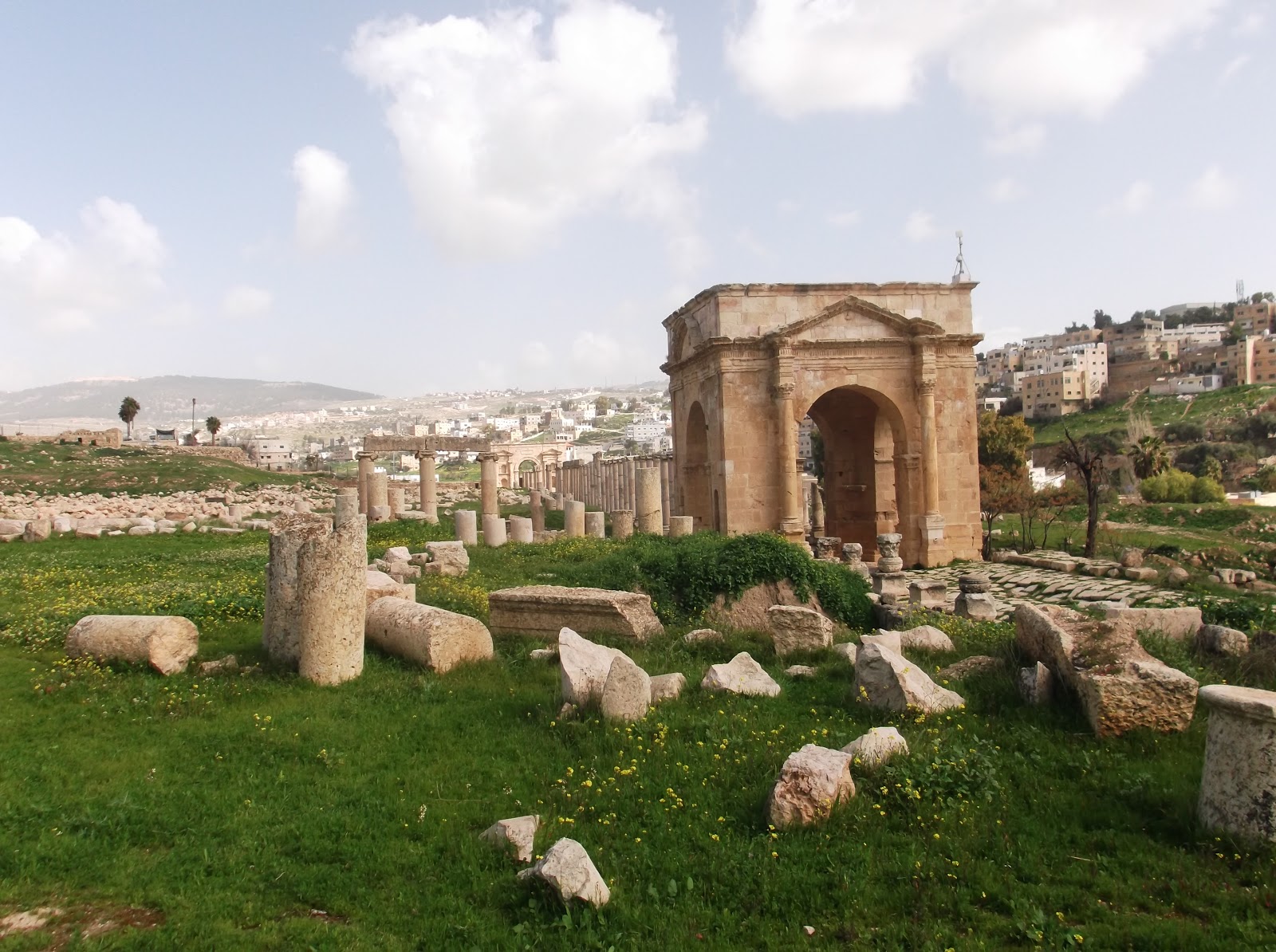
My last full day in Amman I hired a driver to take me to the city of Jerash, which is about an 1 1/2 hours drive north of Amman near the border with Syria. Jerash was initially inhabited from the Neolithic times, but grew largely during the Roman period of conquest and occupation. The city was largely deserted after a devastating earthquake in 747 AD, but the ruins of the buildings built by the Romans are still visible. As you can see, although Jerash is one of the most famous archeological areas in Jordan, there were herds of goats grazing among the ruins.


On the return trip to Amman I asked my driver to take a side trip to Ajloun Castle which was built on the highest hill in the area between 1184 and 1188 AD by one of Saladin's generals. This castle affords a grand view over the Jordan Valley and served as a defense against the Crusaders. The castle was subsequently destroyed and rebuilt over the centuries, finally succumbing to a series of devastating earthquakes in 1837 and 1927. The next to last photo is of the Jordan River outside of Amman.


I had a wonderful time during the week I spent in Amman and the country of Jordan. It is an area with thousands of years of history, as well as an area which is in the forefront of the current Middle East issues and problems. I hope that the future will be as glorious for Jordan as its past has been.


